HISTORY OF WINTERGREEN VILLAGE
and the Southern Rockfish Valley
by Elizabeth G. Richardson
The village of Wintergreen has a long and varied history. It was for years the center commercially and socially for the surrounding farm community, a beehive of activity hard to imagine from the small quiet area today. Over the years, operations near the intersection of today’s Route 151 and Spruce Creek Lane included a number of general stores, several mills, a series of post offices and voting precincts, saloons, two public schools, three churches, a distillery, blacksmith shop and foundry, wheelwright shop, several large tobacco barns, vineyard, orchards, and of course farms. Today, only one general store (now a museum) and a church remain at the intersection.
The community was known by the name of Slaughter(s) from the early 1880s till around 1900, after Samuel Slaughter, who established the area’s first post office in his store in 1881. In 1902 the name of the post office was changed to Wintergreen, after the adjacent farm of which the village had once been a part, and the community came to be known by the same name.
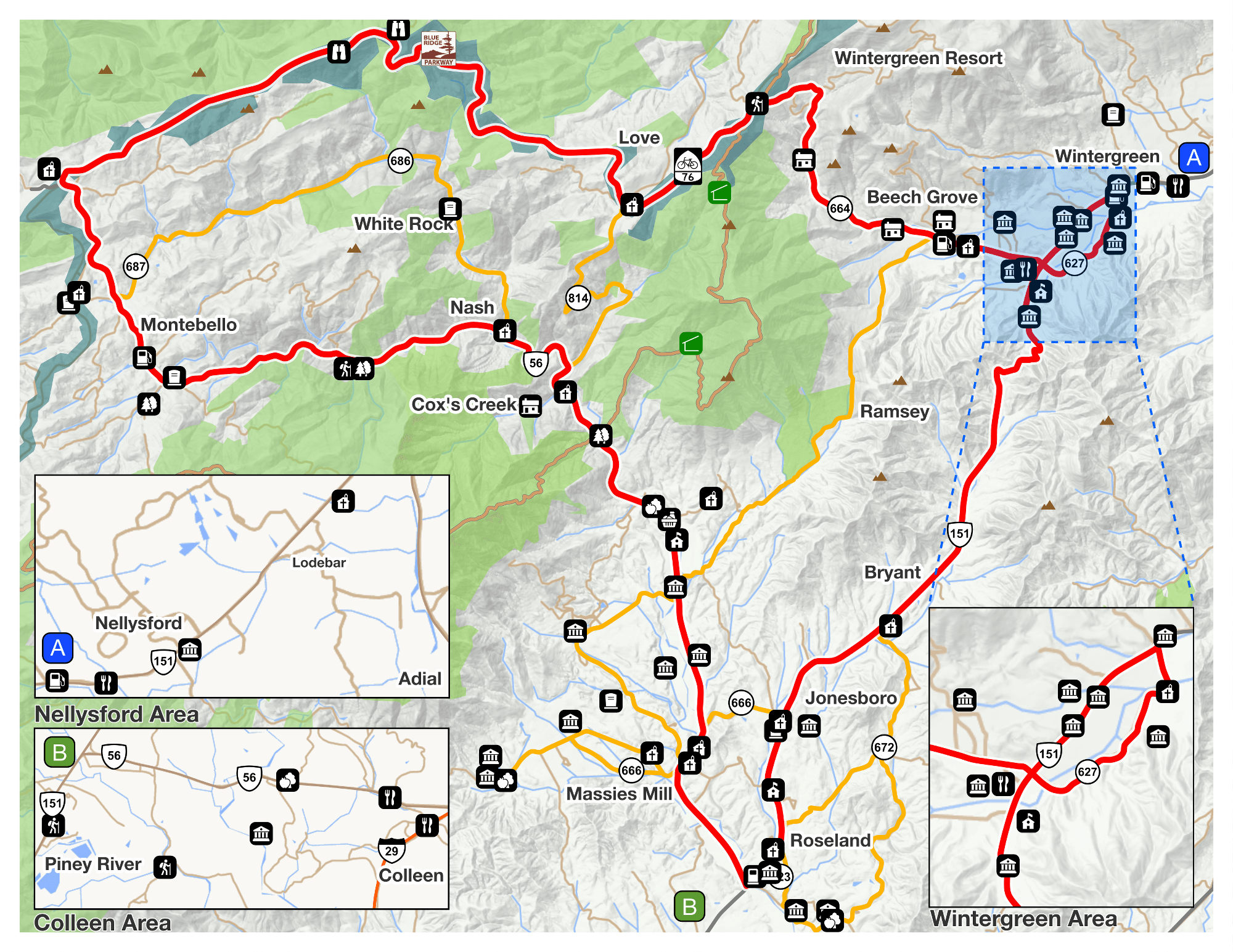
In visualizing Wintergreen village as it appeared in the past, it is helpful to know that, from about 1879 until the latter 1930s, what is now Route 151 from Nellysford turned sharply at Wintergreen and followed what is now Glenthorne Loop around to Beech Grove Road. The section of Route 151 which today runs directly from Wintergreen village to Beech Grove Road at Ski Barn did not exist previously. (Before 1879, the public road bypassed the Wintergreen village completely, running entirely on the other side of the Rockfish River in this area.) When the highway was reconfigured through the area in the 1930s, it was paved for the first time. The first electric line in Nelson County was strung along this highway from Afton through Wintergreen village to Foster’s Store on Beech Grove Road in 1938.
Land ownership by Europeans in what was to become Nelson County began in the early 1730s. At the time, this was part of Goochland County, becoming Albemarle County in 1744, Amherst in 1761, and finally Nelson County in 1807. As would be expected, the first land grants or patents were on the James River, but interestingly, next leap-frogged up to the Rockfish Valley, starting in 1735. This development was probably due to a combination of the availability of fertile well-watered and relatively-level land in the area and from Scots-Irish settlers crossing the Blue Ridge Mountains from the Valley of Virginia. By 1740, almost all land had been claimed on both sides of the south fork of the Rockfish River.
Rockfish is said to be another name for the striped bass which reportedly once migrated up the river before dams were built on the James River. The south fork of the Rockfish rises on Devil’s Knob Mountain within Wintergreen Resort, flows down beside Beech Grove Road (Route 664), before turning north through the pastoral southern Rockfish Valley, past Wintergreen village, to join the river’s north fork near Route 6. The main stream of the river flows southeastwards from there to Howardsville on the James River. It was known as the Rockfish River by at least 1730.
(It is interesting to note that patents and deeds of the 1700s show the main waterways in the area with names quite different from those of today. The beginning of the south fork of the Rockfish River as it came down the mountain and through the Beech Grove area was then known as Stony Creek or Run, Spruce Creek was referred to as either Shamokin or Shoemaking Creek, and the present Stoney Creek was for some unknown reason called Bermudian or Bermuding. But by 1800, those names familiar to us today had come into use.)
Roads or paths quickly developed along the Rockfish River in order to access the farms that early grew up in its valley. The earliest known mention of a public road in the area appears in a 1740 Goochland road order stating the intention to build a road from a gap “above Morrison’s” (probably Cub Creek or Brent’s Gap) through the southern Rockfish valley to join the present Route 250 probably a little west of Charlottesville.
The largest patent in the Southern Rockfish Valley was 2460 acres, stretching from Stoney Creek on the outskirts of Nellysford, south to the foot of Horseshoe Mountain near Beech Grove. This vast tract was first patented in 1739 by a wealthy eastern land speculator, John Chiswell, who sold the whole patent to a Thomas Morrison a year later. However, problems with the patent resulted in it being reissued to William Morrison in 1748.
The Morrisons had been living in the future Wintergreen area since at least 1740. William Morrison quickly sold most of his patent to Morrison relatives and members of the Reid family, retaining 420 acres for himself. These two families were representative of the many Scots-Irish who migrated south from Pennsylvania to settle the Valley of Virginia. Less well-known is that a number of them almost immediately crossed over gaps in the Blue Ridge Mountains to settle in what became Albemarle and Nelson Counties.
In contrast to absentee land speculators from eastern Virginia, the families mentioned above made their homes on their property. In the late 1700s, many of the descendents of these original settlers moved west and south, selling their land to families seeking new land for tobacco to replace their worn out fields in eastern Virginia. The Morrisons and Reids, who had owned the area’s land through much of the 1700s, gave way to newcomers such as the Colemans and Goodwins, as well as the Montgomerys, who accumulated large amounts of land and built or expanded large plantation homes in the valley. Five of the six old homes near Wintergreen village were owned by the Coleman family for much of the 1800s, with descendents or relatives continuing to own three of them through much of the 1900s. The Phillips family owned the other three during most of the 1900s and their descendents still own these properties today.
Wintergreen Resort, developed in the 1970s, took its name from the village and farm of Wintergreen, supposedly because the name was already shown on Virginia road maps.
Readers are encouraged to contact the Nelson County Historical Society with any additional information and pictures they may have.
Recognition and appreciation is given to Elizabeth G. Richardson, a member of the South Rockfish Rural Historic District Committee
