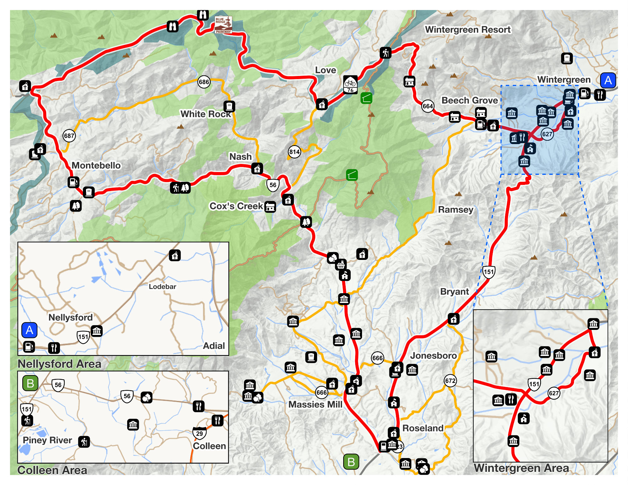
View Nelson Scenic Loop in a larger map
NELSON SCENIC LOOP CAN BE ACCESSED AT DIFFERENT POINTS ALONG THE LOOP.
WE RECOMMEND YOU BEGIN AT SPRUCE CREEK PARK ON RT 151 SOUTH OF NELLYSFORD, VA 22958
From areas east and northeast:
From I-66, take Exit 43a (Gainesville, Rt. 29 South). Follow 29 South to I-64 West (in Charlottesville). Take I-64 West to Exit 107 (Crozet, Rt. 250) Take 250 West to Rt. 151 South, turn left. Follow Rt. 151 South to SPRUCE CREEK PARK 12.7 miles.
From areas south:
Take Rt. 29 North to Rt. 151 North, turn left. Follow Rt. 151 for 22.2 miles to Rt. 627 and SPRUCE CREEK PARK.
From areas west, northwest and southwest:
Take I-81 to I-64 East to Exit 99 (Afton, Rt. 250). Take Rt. 250 East to Rt. 151 South, turn right. Follow Rt. 151 South to Rt. 664, 12.7 miles TO SPRUCE CREEK PARK
From the Blue Ridge Parkway:
At Reid’s Gap exit (between mileposts 13 and 14). east on Rt. 664 TO rt 151, turn left on Rt 151 and proceed 1.5 miles to SPRUCE CREEK PARK. Please note that during the winter the Parkway is not plowed and is frequently closed. We also do not recommend the Parkway when there is fog. Please use an alternate route.