Table of Content
Cover Sheet
Acknowledgments
Purpose and Introduction
Hurricane Camille
History
Dam Removal and Fish Populations
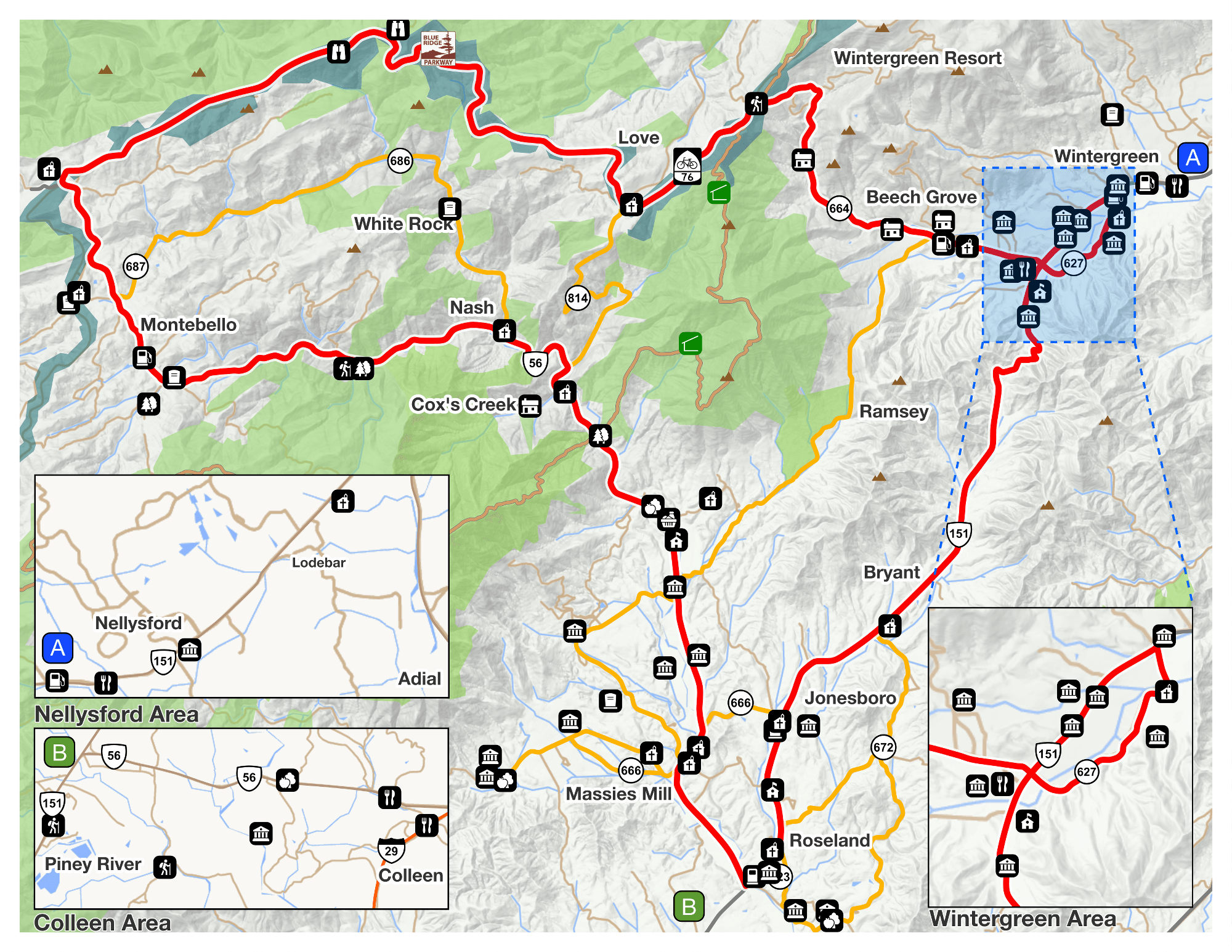
Recreation
Monitoring the River
Testing the Health of a Waterway
Runoff and Non-Point Source Pollution
Best Management Practices and Buffers
Stormwater and Erosion
Invasive Species
River Survey
Related Studies
Conclusions and Opportunities
Works Cited
To assure that the water is safe for recreation and the many domestic uses of the river water, the Department of Environmental Quality (DEQ) performs water quality monitoring on the river. The monitoring is either pointed or done at random. Citizens can submit requests for certain areas of the river to be tested (Quality, My Citizen Nomination Sites 2008). Also, before issuing a permit for either agriculture or industrial construction the DEQ will perform a test of water quality for that specific site and determine whether the site is in need of a Toxics Monitoring Program which implements frequent biological testing to assure that the establishment of the infrastructure is not having any negative effects on the aquatic life (VPDES). The DEQ also adopted a program called Probabilistic Monitoring to obtain water quality data at random.
Probabilistic Monitoring is a program developed by the DEQ in 2000 and began testing in 2001. Probabilistic Monitoring uses targeted testing stations to assess biological, chemical and physical aspects of water quality in Virginia’s river system regardless of the current health of the river. The stations sample water quality, with the testing site being chosen at random by a computer program. Probabilistic Monitoring was established in efforts to provide Virginia citizens with an ongoing update of the overall conditions of their local rivers (Quality, Probabilistic Monitoring). The Tye River probabilistic monitoring station is 1/3 mile downstream from Route 654 where data is collected at random (DEQ BioMon Station Info). The results from the random testing will be used to supplement Total Maximum Daily Load (TMDL) studies. There is a threshold for the amount of pollutants that a particular ecosystem can tolerate. The TMDL limits are established according to the needs and of the aquatic life in the estuarine habitat. Factors such as the size of the body of water, the velocity and the average amount of discharge, and point and non-point source pollution that affects the river are all taken into consideration during TMDL studies. (Quality, TMDL Development).
Each state has its own set of parameters for determining TMDL standards for its particular bodies of water (Miller 2006). Total Maximum Daily Load is determined for rivers that are considered impaired waters in Virginia. The Clean Water Act section 305(d) requires that all states establish a biennial report containing a full assessment of the quality of all navigable waters in the state. From the data collected in this report an alternate list of impaired waters will be developed. This Impaired Waters List section 303(d) of the Clean Water Act identifies any navigable waters that pose a threat to the aquatic life, recreation and any possible consumption of the water directly or through the consumption of the aquatic creatures harvested from the body of water. The intent of the Impaired Waters List is to make the obtained data available for public knowledge and ultimately to develop TMDL standards for the impaired body of water. Also the state is required to perform consistent testing to assure that the quality of the water is improving and provide a report accessible to the public to inform of the most current state of the estuarine environment (Quality, Inventory Report to Congress).
The Tye River along with two of its major tributaries, the Piney River and Ruckers Run are listed on the impaired waters list for 2008. The Tye was first listed as impaired in 2004 for Fecal Coliform at two different mile markers; one at 18.26 miles downstream and the other at 7.61 miles downstream of the headwaters. E.Coli is the other major problem found in chemical testing on the Tye. E.Coli, which by DEQ standards has been lumped into the category with Fecal Coliform, was first found to be a problem in 2004. It was found again at the same mile marker, 7.61, and at mile 8.33, less than a mile downstream in 2008. The TMDL development date is listed as 2016 for mile 7.61 and the development date listed for mile 8.33 is 2018. The TMDL development dates set a timeline for DEQ. Monitoring of these particular sites will begin approximately two years before the determined development date. This will give the department time to collect the most accurate data and to determine any changes to the water quality following its listing. From the data gathered, a TMDL plan will be developed and instituted on the impaired waterway. Monitoring on the Tye River has historically taken place at several different sites of the river. In 2008, DEQ discontinued testing at all but one site. The site that remains is at the Route 29 Bridge at the county line of Nelson and Amherst. Testing on other sites will resume in 2013 and the data gathered will supplement the monitoring data from the TMDL development plan (Personal Communication with James Beckley ‘DEQ’). Recreation is noted as the impaired use as a result of the Fecal Coliform. The Piney River, Buffalo River and Rucker Run are all tributaries of the Tye River. The Piney flows into the Tye at waypoint 110 in Section 3 and at waypoint 154 in Section 6 Ruckers Run converges with the Tye River.