Table of Content
Cover Sheet
Acknowledgments
Purpose and Introduction
Hurricane Camille
History
Dam Removal and Fish Populations
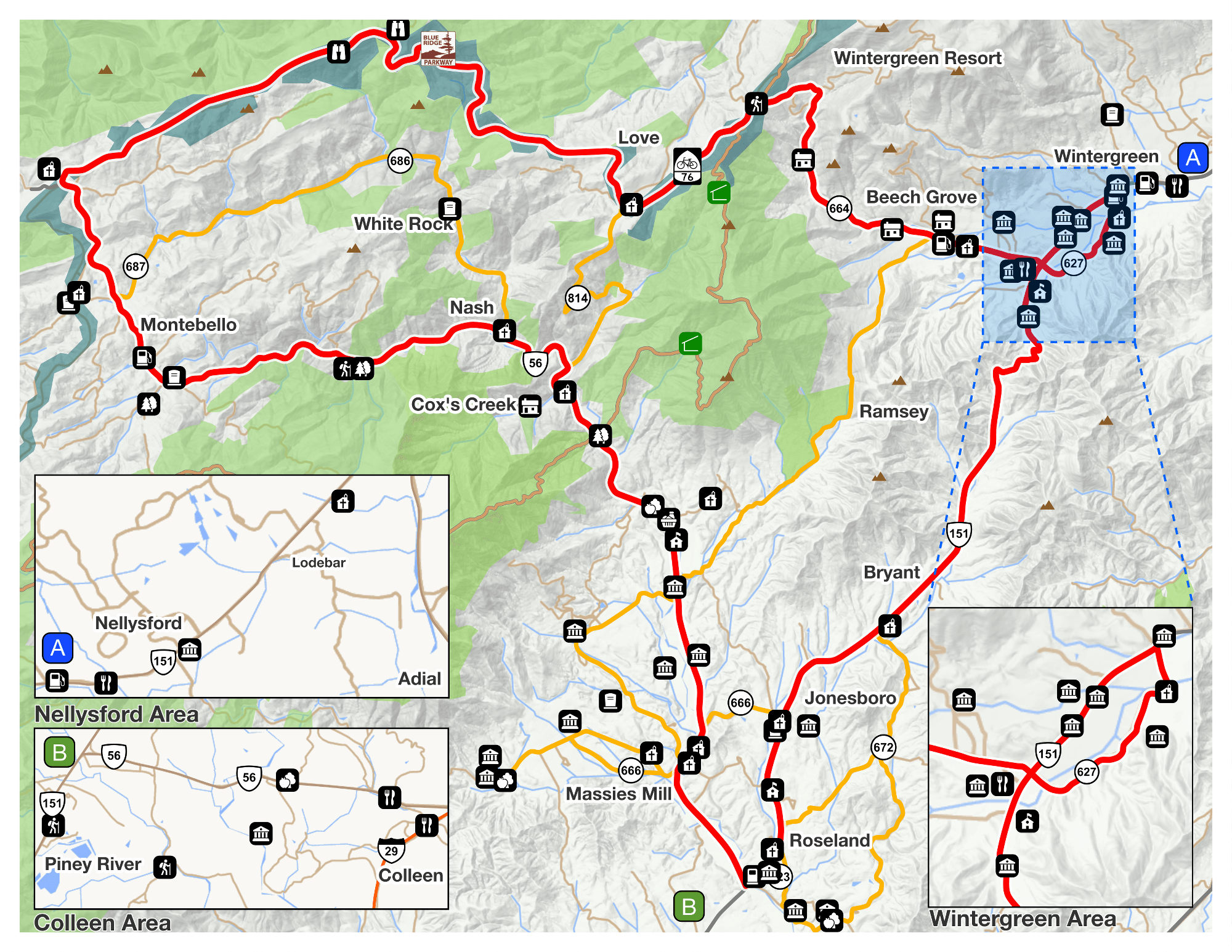
Recreation
Monitoring the River
Testing the Health of a Waterway
Runoff and Non-Point Source Pollution
Best Management Practices and Buffers
Stormwater and Erosion
Invasive Species
River Survey
Related Studies
Conclusions and Opportunities
Works Cited
In order to develop TMDL’s or acceptable levels of contaminants in public waters, the pollutants must first be identified within the water as well as the source that generates the pollutants. Two major classifications of pollutants are point source pollution and non-point source pollution. Point source pollution is that which can be identified directly from the source. Non-point source pollution is more difficult to identify, as it describes those pollutants that come indirectly from industrial practices, residential discharge, and urban and agriculture runoff. Non-point source pollution is noted as one of the highest contributing factors to impaired waters (EPA, Polluted Runoff). In Virginia a watershed assessment of non-point source pollution was prepared by the Virginia Department of Conservation and Recreation (DCR) and the Division of Soil and Water Conservation (DSWC), collectively referred to as DCR-DSWC. In the conducted testing and identifying of non-point source pollution, three major contributors were selected and all pollution was categorized under these three sectors. Agriculture, urbanization and forestry are three general classifications of Virginia land use. Each land type was assessed for its runoff, small and large-scale practices and several other factors that may contribute to runoff or erosion directly affecting the quality of the adjacent waterways. Particular sites were the assessment was done were ranked according to the level of non-point sources of pollution that were found in the watershed. The sites were categorized as constituents of High, Medium, or Low percentages of non-point source pollution. The Lower Tye River was assessed for its NPS pollution and found to be in the lower percentage ranking, thus posing little threat to that particular area of the Tye River (Quality, Nonpoint Source Assessment).
URBANIZATION
Urbanization is taking place all over Virginia with the Northern region seeing the first big boom and eventually moving down the state. Urbanization brings with it roads, sidewalks and parking lots, all of which are considered impervious surfaces in that water cannot penetrate the surface. When rainwater hits these surfaces, the build-up of toxins from typical human inhabitance is moved into the surrounding bodies of waters that make up Virginia’s rivers. (Quality, Nonpoint Source Assessment) Without the absence of impervious surfaces, water is able to more readily infiltrate the ground where the soil layers can act as a filtration system to break down many of the toxins before they contaminate the groundwater.
AGRICULTURE
Along with great commodities such as grapes and apples, cattle comprise one of the largest agricultural endeavors in the county. In 2004, there were 14,000 cattle in the county alone (Agriculture Census). The wastes of the cattle and other stock find their way to streams by way of runoff from rain and percolating into the groundwater. Both avenues will ultimately cause nutrient loading in the water and adversely affect the aquatic life. If the farmland runs directly to the edge of the river, cattle can sometimes be found in the river. This was witnessed once during the visual survey. The farmland was adjacent to a bridge and the cattle had to go down a steep grade to get into the river. There are several reasons why this may be consequential for the farmer. Pollutants from the road near the farmland will run into the river causing higher levels of toxins and adversely affecting the herd of cattle that is drinking the water and wading in the river. Also, the steep grade that the cattle must brave to access the river could be a potential danger, if not for heifers, for calves. This also causes erosion. With respect to water quality, the cattle in the river can cause pathogens or other contaminants to be carried down the river. Another site along the river had no cattle in it at the time, but had a barbed-wire fence that was posted in the river channel. The cattle had about 50 square feet of access to the river. The same consequences are found for this situation as well as the possibility of the fence getting washed away and the cattle having no barrier at all from the river.
FORESTRY
Forestry practices also create surface build-up that is moved into the rivers. However, the condition generated by forestry practices is usually bare ground, exposing soil that can move in mass quantities into rivers creating an overload of sand, silt, and clay. This sediment loading can increase the turbidity of the water which consequently blocks sunlight from the underwater habitats. Aquatic life is dependent upon a certain amount of sunlight penetrating the surface of the water. (Quality, Nonpoint Source Assessment). One area of the Tye had obviously undergone recent land-clearing. The area has been left with bare soil which will cause sediment loading when the water level in the river rises.
Agriculture, forestry and urban development all require land alterations that create disturbance in the soil. When the majority of the ground surface consists of loose soil or bare soil, the land is at a high risk for erosion. Erosion is both natural and human induced. Natural erosion is often slower and the process is only exacerbated during major weather events such hurricanes. Erosion caused by human activities occurs at a higher intensity and the results are more immediate. Farming practices historically led to major erosion events, but now with the knowledge gained from past devastating events, like the dust bowl of the 1930’s, more efforts are being placed on erosion control (Miller).
In order to assure that erosion is controlled when land is being disturbed by farming, forestry or construction, government agencies have outlined the best possible ways that those who work on the land can work efficiently while minimizing the effect they have on erosion. These guidelines are called Best Management Practices, or BMPs.(Miller).